![](/images/other/stat-length.png)
![Randonnée A pied Gemeinde Mödling - Wienerwald-Sternwanderweg 42 - Photo](https://media.geolcdn.com/t/1900/400/280a29d9-3911-43f4-80f9-5d397d38f094.jpeg&format=pjpeg&maxdim=2)
Wienerwald-Sternwanderweg 42
SityTrail - itinéraires balisés pédestres
Tous les sentiers balisés d’Europe GUIDE+
![Longueur](/images/other/stat-length.png)
![Altitude max](https://static1.geolcdn.com/siteimages/upload/files/1508320355ic_sort_altitude_max_24dp.png)
![Dénivelé positif](https://static1.geolcdn.com/siteimages/upload/files/1508320355ic_sort_den_pos_24dp.png)
![Km-Effort](/images/other/stat-length.png)
![Altitude min](https://static1.geolcdn.com/siteimages/upload/files/1508320355ic_sort_altitude_min_24dp.png)
![Dénivelé négatif](https://static1.geolcdn.com/siteimages/upload/files/1508320355ic_sort_den_neg_24dp.png)
![Boucle](https://static1.geolcdn.com/siteimages/upload/files/16400158638029165_repeat_loop_refresh_sync_direction_icon.png)
![A pied](https://static1.geolcdn.com/sitytour/trail-icons/100.png)
5h15
Difficulté : Moyen
![Scannez ce code QR pour ouvrir la randonnée dans l'application SityTrail](https://capi.geolives.com/qq0zvz2zws4bq2lad0pu/sitytour/trails/3126034/qr.png?size=200)
Application GPS de randonnée GRATUITE
À propos
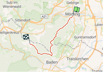
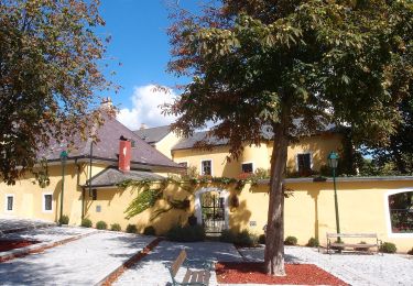
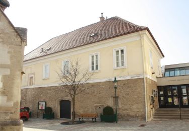
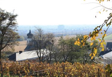
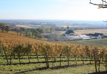
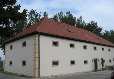
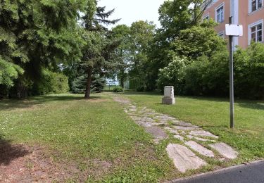
Randonnée A pied de 15,1 km à découvrir à Basse-Autriche, Bezirk Mödling, Gemeinde Mödling. Cette randonnée est proposée par SityTrail - itinéraires balisés pédestres.
Description
Randonnée créée par Organisation der Internationalen Wienerwald-Wanderung.
Eröffnet 1979. Der Betreiber OdIWW existiert seit 20102 nicht mehr.
Symbole: weißer, waagerechter Balken auf rotem Grund mit 42
Localisation
Commentaires
Randonnées à proximité
![Randonnée A pied Gemeinde Biedermannsdorf - Runnersfun Runde - Photo](https://media.geolcdn.com/t/375/260/a0d6cd9e-42da-42c7-9acd-1719f0534d66.jpeg&format=jpg&maxdim=2)
![A pied A pied](https://static1.geolcdn.com/sitytour/trail-icons/100.png)
A pied
![](/images/other/stat-length.png)
![](https://static1.geolcdn.com/siteimages/upload/files/16400158638029165_repeat_loop_refresh_sync_direction_icon.png)
![Randonnée A pied Gemeinde Biedermannsdorf - Heat Runde - Photo](https://media.geolcdn.com/t/375/260/6359e391-f45b-4b26-a871-7b08a6809cdd.jpeg&format=jpg&maxdim=2)
![A pied A pied](https://static1.geolcdn.com/sitytour/trail-icons/100.png)
A pied
![](/images/other/stat-length.png)
![](https://static1.geolcdn.com/siteimages/upload/files/16400158638029165_repeat_loop_refresh_sync_direction_icon.png)
![Randonnée A pied Gemeinde Gumpoldskirchen - Königswein Runde bei Gumpoldskirchen - Photo](https://media.geolcdn.com/t/375/260/06cd12e5-5d35-4666-9d22-7efbab55c909.jpeg&format=jpg&maxdim=2)
![A pied A pied](https://static1.geolcdn.com/sitytour/trail-icons/100.png)
A pied
![](/images/other/stat-length.png)
![](https://static1.geolcdn.com/siteimages/upload/files/16400158638029165_repeat_loop_refresh_sync_direction_icon.png)
![Randonnée A pied Brunn am Gebirge - SPORTaktiv Runde - Photo](https://media.geolcdn.com/t/375/260/b1e41855-ed7f-4339-bf1d-cd5700486e95.jpeg&format=jpg&maxdim=2)
![A pied A pied](https://static1.geolcdn.com/sitytour/trail-icons/100.png)
A pied
![](/images/other/stat-length.png)
![](https://static1.geolcdn.com/siteimages/upload/files/16400158638029165_repeat_loop_refresh_sync_direction_icon.png)
![Randonnée A pied Gemeinde Guntramsdorf - Runnersfun Runde (Guntramsdorf) - Photo](https://media.geolcdn.com/t/375/260/c113addb-d86d-427f-99ef-f58f748261ea.jpeg&format=jpg&maxdim=2)
![A pied A pied](https://static1.geolcdn.com/sitytour/trail-icons/100.png)
A pied
![](/images/other/stat-length.png)
![](https://static1.geolcdn.com/siteimages/upload/files/16400158638029165_repeat_loop_refresh_sync_direction_icon.png)
![Randonnée A pied Gemeinde Guntramsdorf - Rauch Immobilien Runde (Guntramsdorf) - Photo](https://media.geolcdn.com/t/375/260/c17bce65-4238-4873-be8c-f9ffa6c61775.jpeg&format=jpg&maxdim=2)
![A pied A pied](https://static1.geolcdn.com/sitytour/trail-icons/100.png)
A pied
![](/images/other/stat-length.png)
![](https://static1.geolcdn.com/siteimages/upload/files/16400158638029165_repeat_loop_refresh_sync_direction_icon.png)
![Randonnée A pied Gemeinde Vösendorf - Raiffeisen Runde - Photo](https://media.geolcdn.com/t/375/260/0839e94c-7788-4b5f-b505-6a081b707870.jpeg&format=jpg&maxdim=2)
![A pied A pied](https://static1.geolcdn.com/sitytour/trail-icons/100.png)
A pied
![](/images/other/stat-length.png)
![](https://static1.geolcdn.com/siteimages/upload/files/16400158638029165_repeat_loop_refresh_sync_direction_icon.png)
![Randonnée A pied Gemeinde Vösendorf - 1A Installateur Runde - Photo](https://media.geolcdn.com/t/375/260/4a503fdc-3ee3-41b3-8afd-8692fad0a31c.jpeg&format=jpg&maxdim=2)
![A pied A pied](https://static1.geolcdn.com/sitytour/trail-icons/100.png)
A pied
![](/images/other/stat-length.png)
![](https://static1.geolcdn.com/siteimages/upload/files/16400158638029165_repeat_loop_refresh_sync_direction_icon.png)
![Randonnée A pied Gemeinde Wiener Neudorf - ecoplus Runde - Photo](https://media.geolcdn.com/t/375/260/683bd57f-866e-4573-9016-427719cd48f9.jpeg&format=jpg&maxdim=2)
![A pied A pied](https://static1.geolcdn.com/sitytour/trail-icons/100.png)
A pied
![](/images/other/stat-length.png)
![](https://static1.geolcdn.com/siteimages/upload/files/16400158638029165_repeat_loop_refresh_sync_direction_icon.png)